Thursday, May 02, 2024
TODAY’S WEATHER DISCUSSION AND FORECAST
..Good Morning.
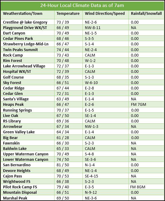
..Once again Fog has moved into the Valley but is patchy this morning and not a problem for driving. This is due to a surface level Eddy off of San Diego that is helping to push the Marine layer Inland this morning. Fog and low clouds will be increasing over the next few days and deepening as well to above parts of the Rim for the weekend.
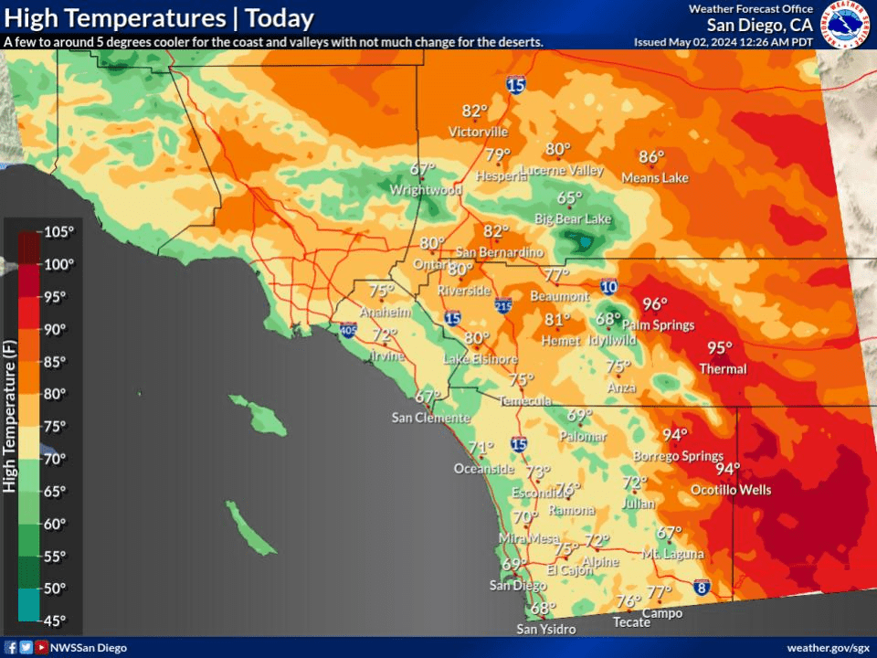
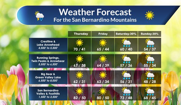
..Temperatures today will be a little cooler than what we saw yesterday. Daytime highs for the Arrowhead and Crestline areas will be from 65-70* today. For the higher elevations of Big Bear, Green Valley Lake and Running Springs, today’s highs will be running in the low to mid 60s.
..Clear skies with light NE winds for most area will be the days outlook.
..LOOKING AHEAD:
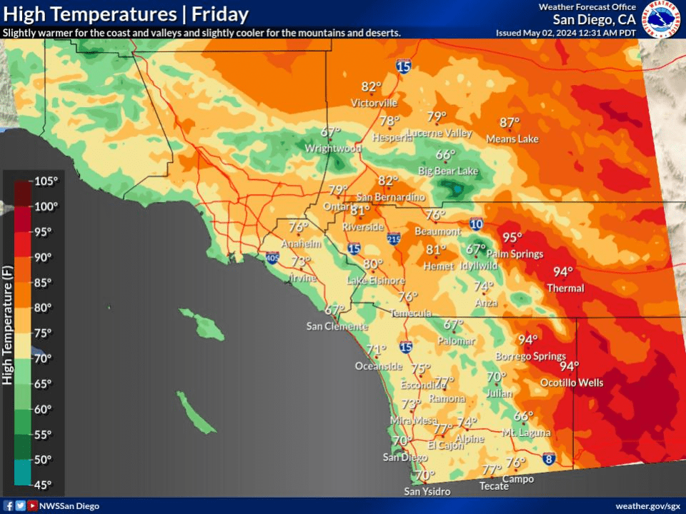
..Friday will be another nice day across the Mountain with similar daytime temperatures. Onshore winds will be picking up later in the day as a quick change will arrive for Saturday and Sunday.
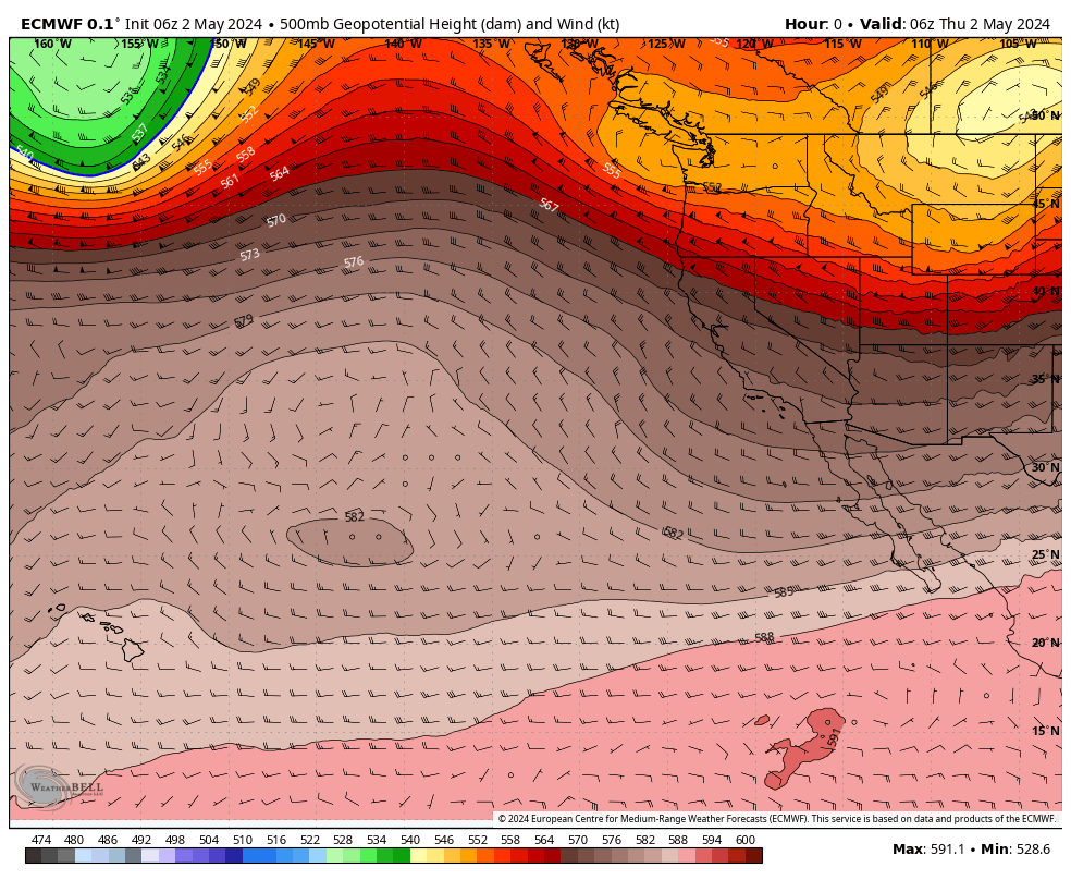
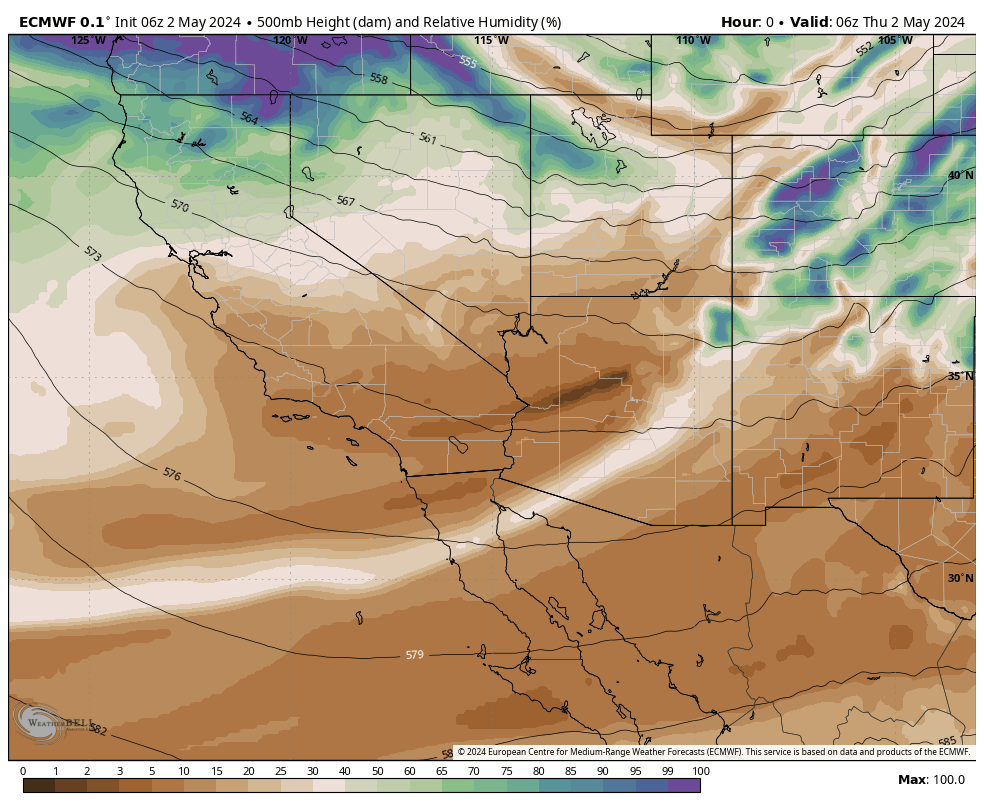
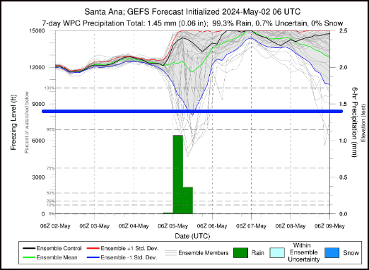
..As we head into the weekend, temperatures will rapidly cool down as a Trough of Low pressure drops South out of the Gulf of Alaska. This area of Low pressure will move through the PAC-NW Saturday, into Nor-Cal Sunday morning, then exit stage Right into the Great Basin Region, then East from there Monday.
..As this system passes through the PAC-NW, a trailing Trough will pass over SoCal bringing gusty winds locally and especially in the Deserts also bringing a chance for scattered showers locally for Saturday and Sunday morning.
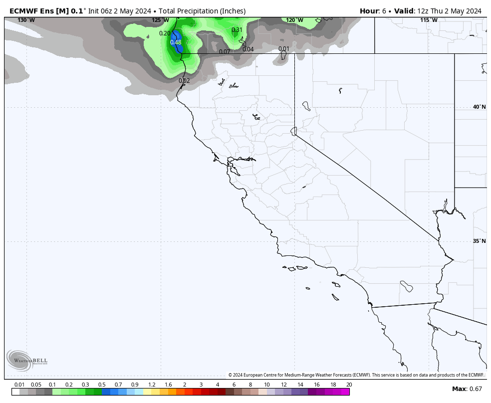
..For the weekend we can expect to have cloudy skies with Fog developing along and below the Rim at times through Sunday morning. Then a switch to gusty NE winds as the Low moves East for Sunday night and Monday. Rainfall totals are not expected to be much ranging from .10-.40″ at best.
..CRYSTAL BALL OUTLOOK:
..After all of this passes to our East by Monday, we will be under a weak area of High pressure that will be centered over the Pacific to our West, that will put us in a more Zonal flow aloft. Temperatures will begin to warm up again through the work week as it looks now.
..As we head into the first week of May, it is time to start thinking about the June 1st weed abatement clearance deadline. This past year with not much drying of the vegetation due to the cooler than normal Summer and the rain from Hilary promoting a very long growing season. This year as we return to LA Nina, we will likely see a warmer and drier Summer and Fall. So clearing out all the extra growth will take a little longer. I expect to see a rather busy Fire Season by late Summer lasting well into Fall. So be sure to get that yard cleanup done.
..My weather forecasts are derived from what I feel is the most probable outlook for our area. RC