Friday, April 19, 2024


TODAY’S WEATHER DISCUSSION AND FORECAST
..Good Morning.
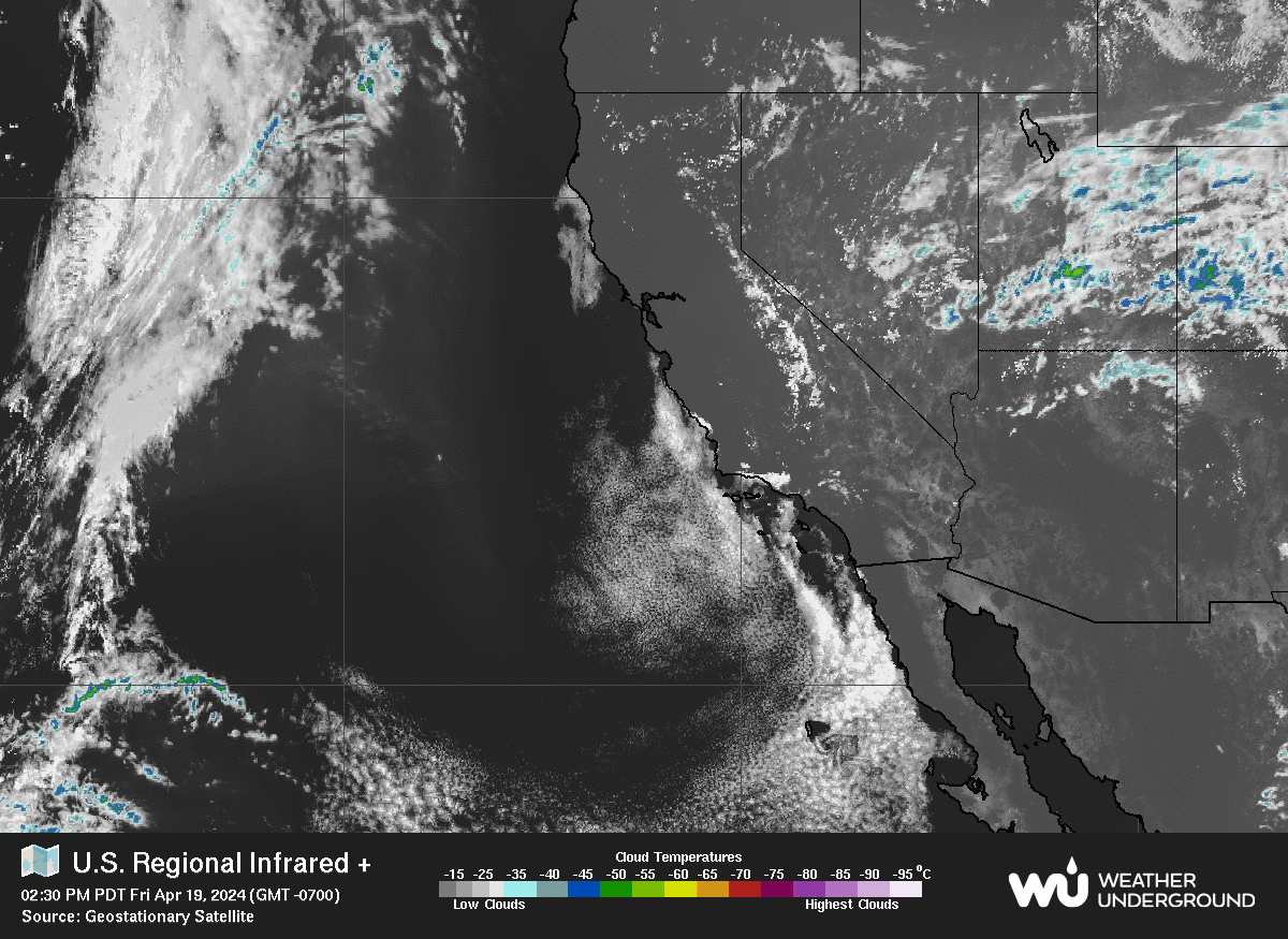
..This morning the Marine layer has moved into the IE up to a depth of around 2500-3000′ level. This will burn off by later this morning as daytime heating develops. There are also some Sub-Tropical Cumulus type clouds at the mid and upper level of the Atmosphere that will give the sky some character.
..A weak area of Low pressure will pass over SoCal today that should bring slightly cooler temperatures as well as gusty SW winds later today, as the Trough passes by.
..Behind the Trough, a Ridge will build over the West that will bring a short, but quick warming trend to the local area for Saturday through Monday.
..Daytime high temperatures will peak Sunday and Monday locally before a cooling trend begins for all of next week. There will be Moring Fog in the Valley again tomorrow morning possibly into the local Foothills, again up to ~3000′ then dissipating by late morning.
..LOOKING AHEAD:
..As we head into next week, there will be a couple of short waves pass over the SoCal Region from areas of Low pressure to our North.
..As we go through the work week, temperatures will be cooling off slowly each day through the weekend. By Friday we could see a chance for a few scattered showers move through SoCal into Saturday morning.
..CRYSTAL BALL OUITLOOK:
..After the chance for scattered showers passes by Saturday the 27th, High pressure will again build across the Region with a warming trend to follow. RC
..The EL NINO is fading rapidly as we transition to an ENSO Neutral pattern for the next four to six months.
..My weather forecasts are derived from what I feel is the most probable outlook for our area. RC