
EL NIÑO SOUTHERN OSCILLATION (ENSO)
ENSO Alert System Status: El Niño ADVISORY
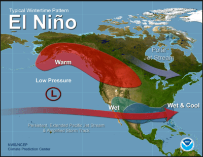


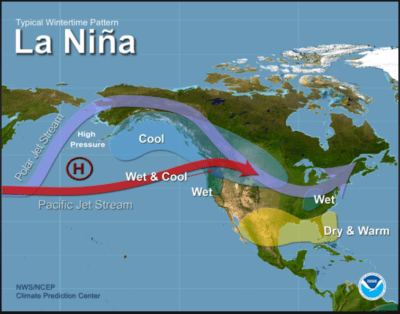
| EL NIÑO/SOUTHERN OSCILLATION (ENSO) |
| DIAGNOSTIC DISCUSSION |
| issued by CLIMATE PREDICTION CENTER/NCEP/NWS |
| 11 April 2024 |
|
ENSO Alert System Status: El Niño Advisory / La Niña Watch |
|
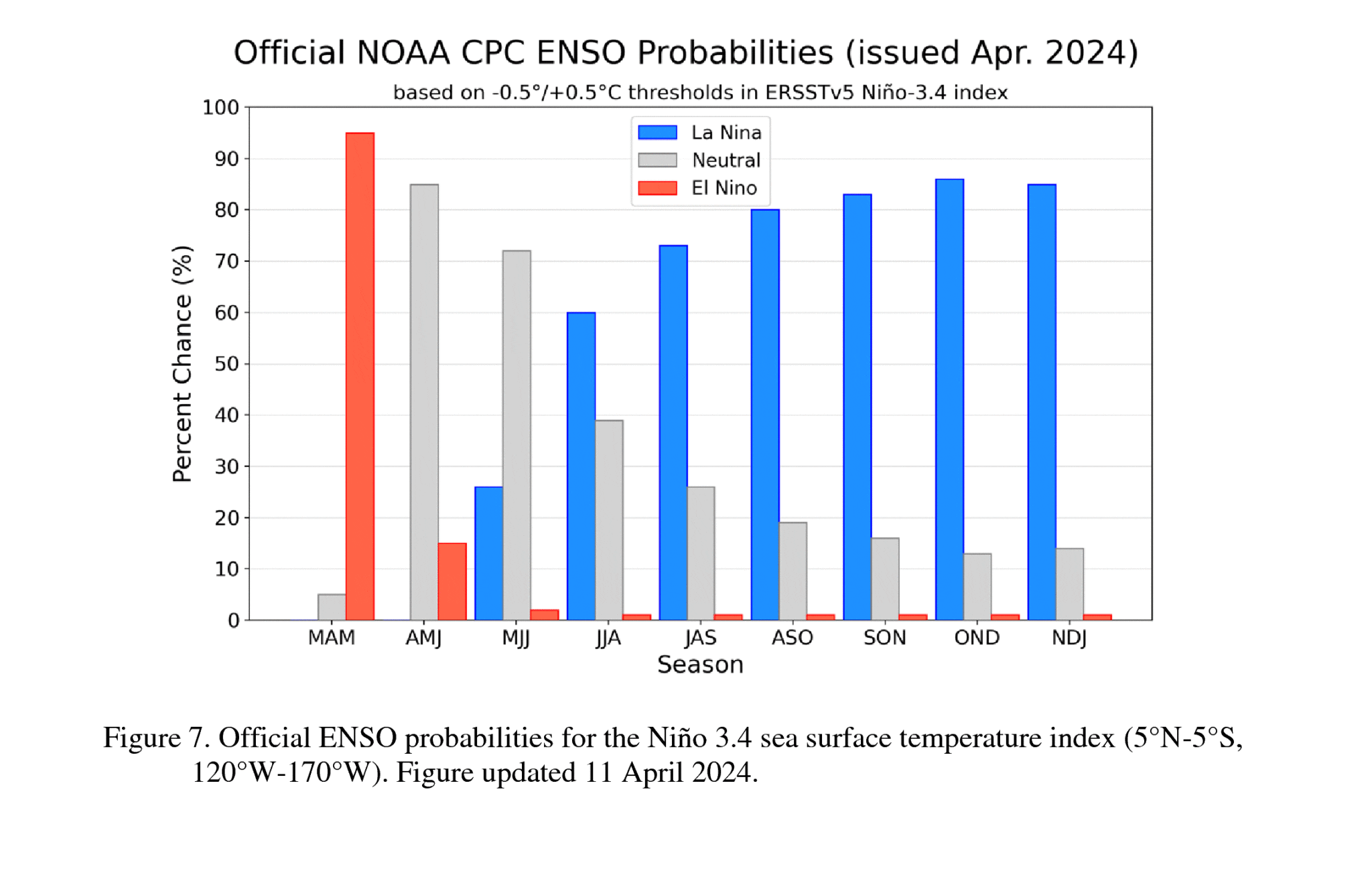
Synopsis: A transition from El Niño to ENSO-neutral is likely by April-June 2024 (85% chance), with the odds of La Niña developing by June-August 2024 (60% chance). During March 2024, sea surface temperature (SST) anomalies continued to weaken across most of the equatorial Pacific Ocean. SST anomalies were coolest in the far eastern Pacific Ocean [Fig. 1], with the latest weekly Niño-1+2 value at -0.1°C [Fig. 2]. Weekly SST index values in the other Niño regions were between +0.9°C and +1.2°C. Below-average subsurface temperatures strengthened (area-averaged index in [Fig. 3]), reflecting the expansion of negative subsurface anomalies associated with an upwelling Kelvin wave [Fig. 4]. Low-level wind anomalies were easterly over the west-central equatorial Pacific, while upper-level wind anomalies were mostly near average. Equatorial convection was slightly suppressed around the Date Line and was near average around Indonesia [Fig. 5]. Collectively, the coupled ocean-atmosphere system reflected the continued weakening of El Niño. The most recent IRI plume indicates a transition to ENSO-neutral during spring 2024, with La Niña potentially developing during late summer 2024 [Fig. 6]. The forecast team continues to favor the dynamical model guidance, which is slightly more accurate than statistical models during this time of year. La Niña tends to follow strong El Niño events, which also provides added confidence in the model guidance favoring La Niña. In summary, a transition from El Niño to ENSO-neutral is likely by April-June 2024 (85% chance), with the odds of La Niña developing by June-August 2024 (60% chance; [Fig. 7]). |
![[Fig. 1]](https://www.cpc.ncep.noaa.gov/products/analysis_monitoring/enso_advisory/figure01.gif)
![[Fig. 2]](https://www.cpc.ncep.noaa.gov/products/analysis_monitoring/enso_advisory/figure02.gif)
![[Fig. 3]](https://www.cpc.ncep.noaa.gov/products/analysis_monitoring/enso_advisory/figure03.gif)
![[Fig. 4]](https://www.cpc.ncep.noaa.gov/products/analysis_monitoring/enso_advisory/figure04.gif)
![[Fig. 5]](https://www.cpc.ncep.noaa.gov/products/analysis_monitoring/enso_advisory/figure05.gif)
![[Fig. 6]](https://www.cpc.ncep.noaa.gov/products/analysis_monitoring/enso_advisory/figure06.gif)
![[Fig. 7]](https://www.cpc.ncep.noaa.gov/products/analysis_monitoring/enso_advisory/figure07.gif)
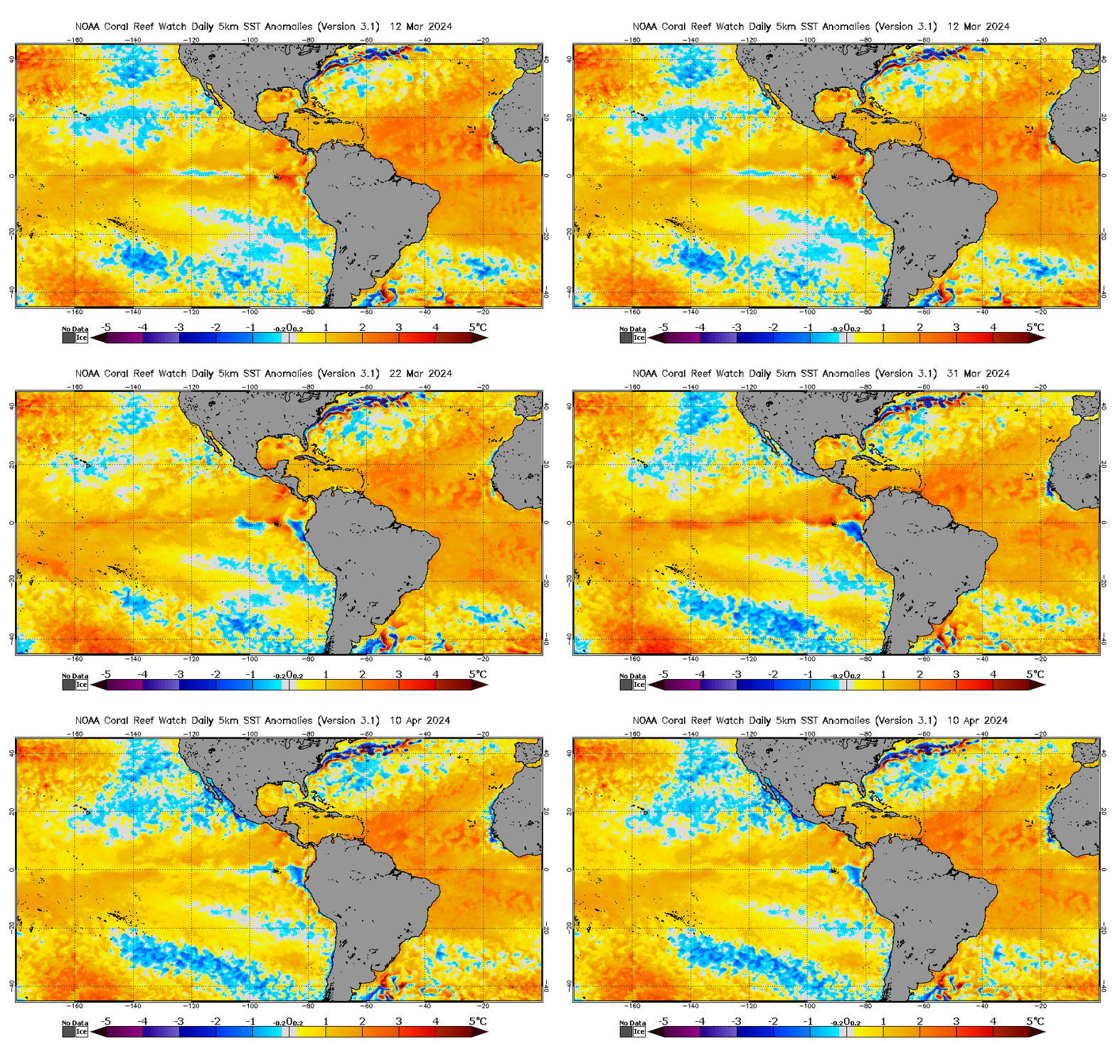
EASTERN PACIFIC SST ENSO3.4 ANIMATION
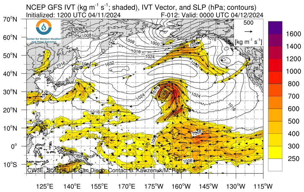
AR FORECAST
RAINFALL FORECAST 90 DAY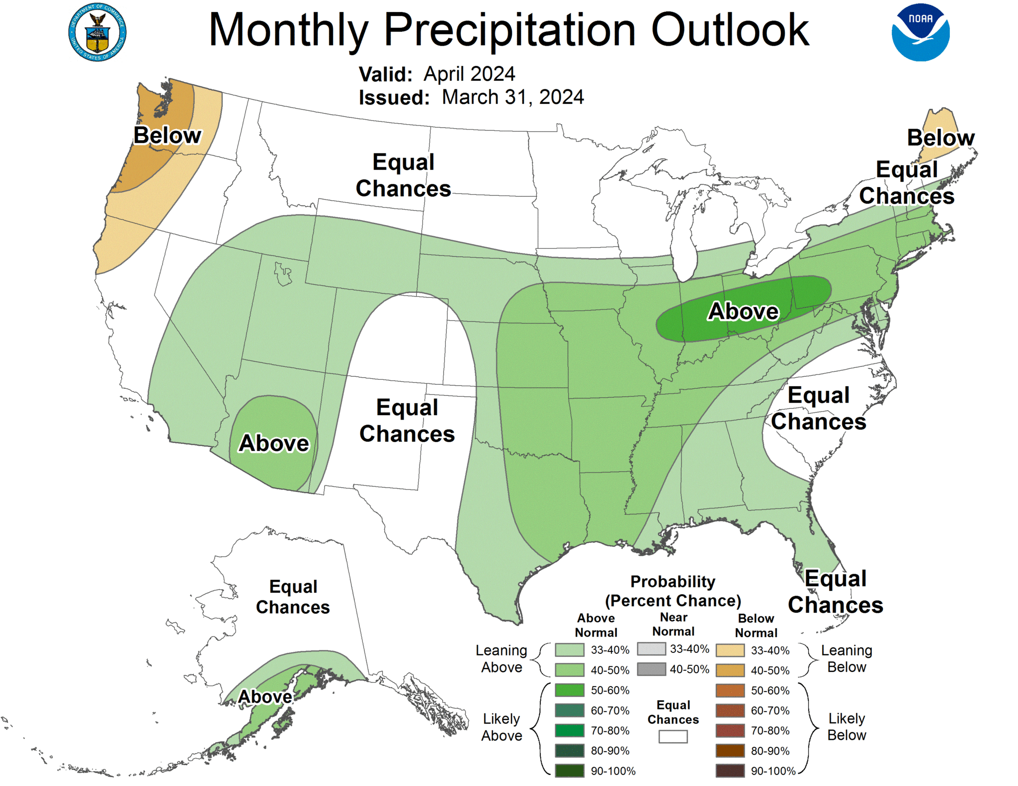
ENSO OUTLOOK
APRIL SST’S OUTLOOK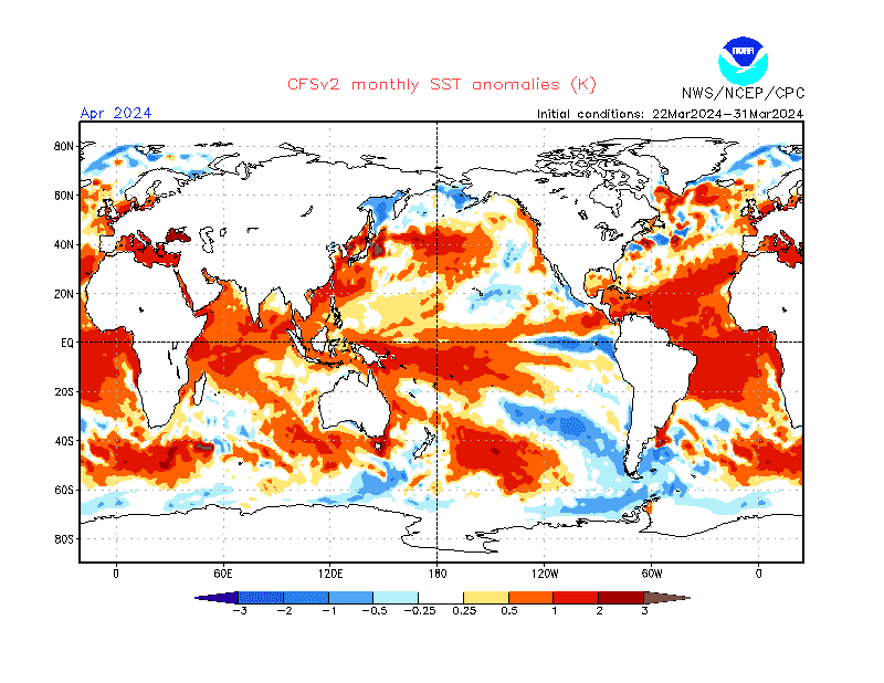
SST’S OUTLOOK FOR MAY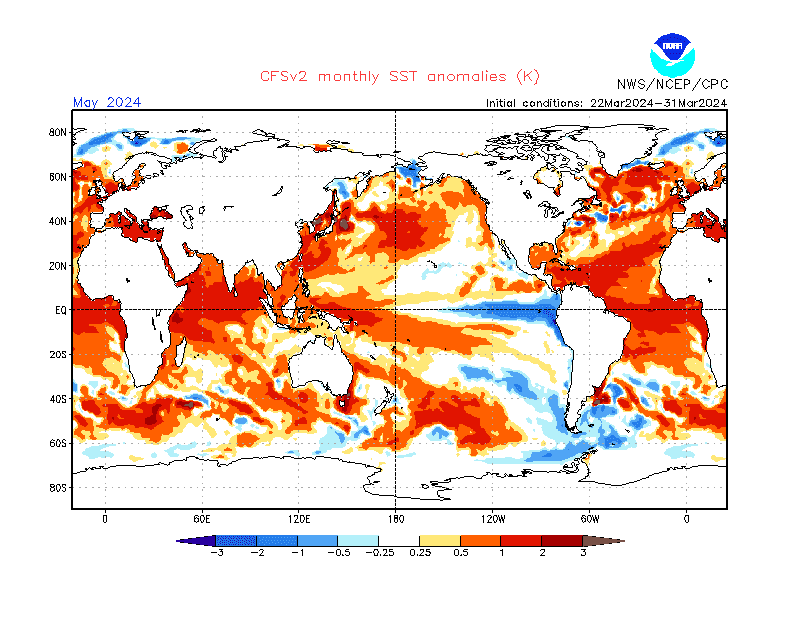
SST’S OUTLOOK FOR JUNE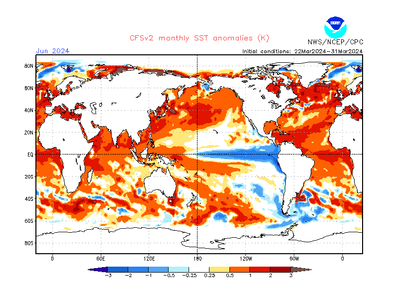
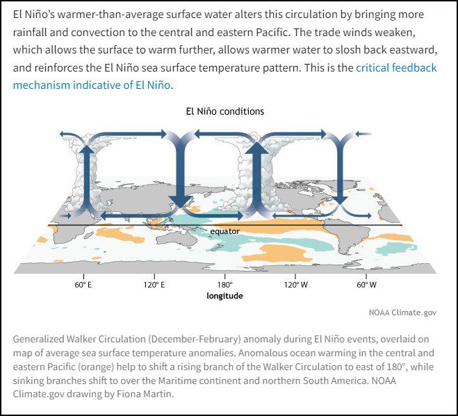
WALKER CIRCULATION EL NINO
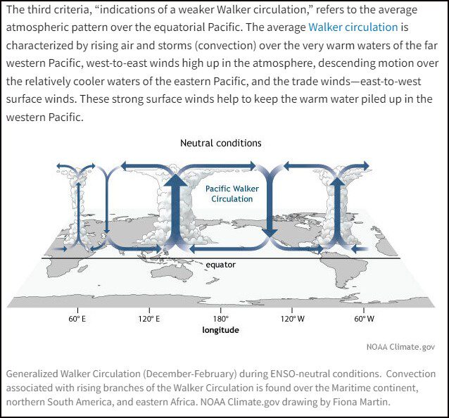
WALKER CIRCULATION NEUTRAL
Thank You, for visiting Lake Gregory Weather ( lakegregoryweather.com ). Your local source for Weather information in the San Bernardino Mountains.