
WARNINGS AND HAZARDS
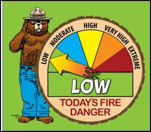
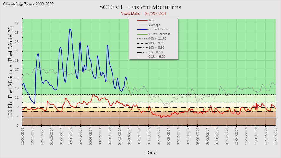
TODAY’S FIRE LEVEL
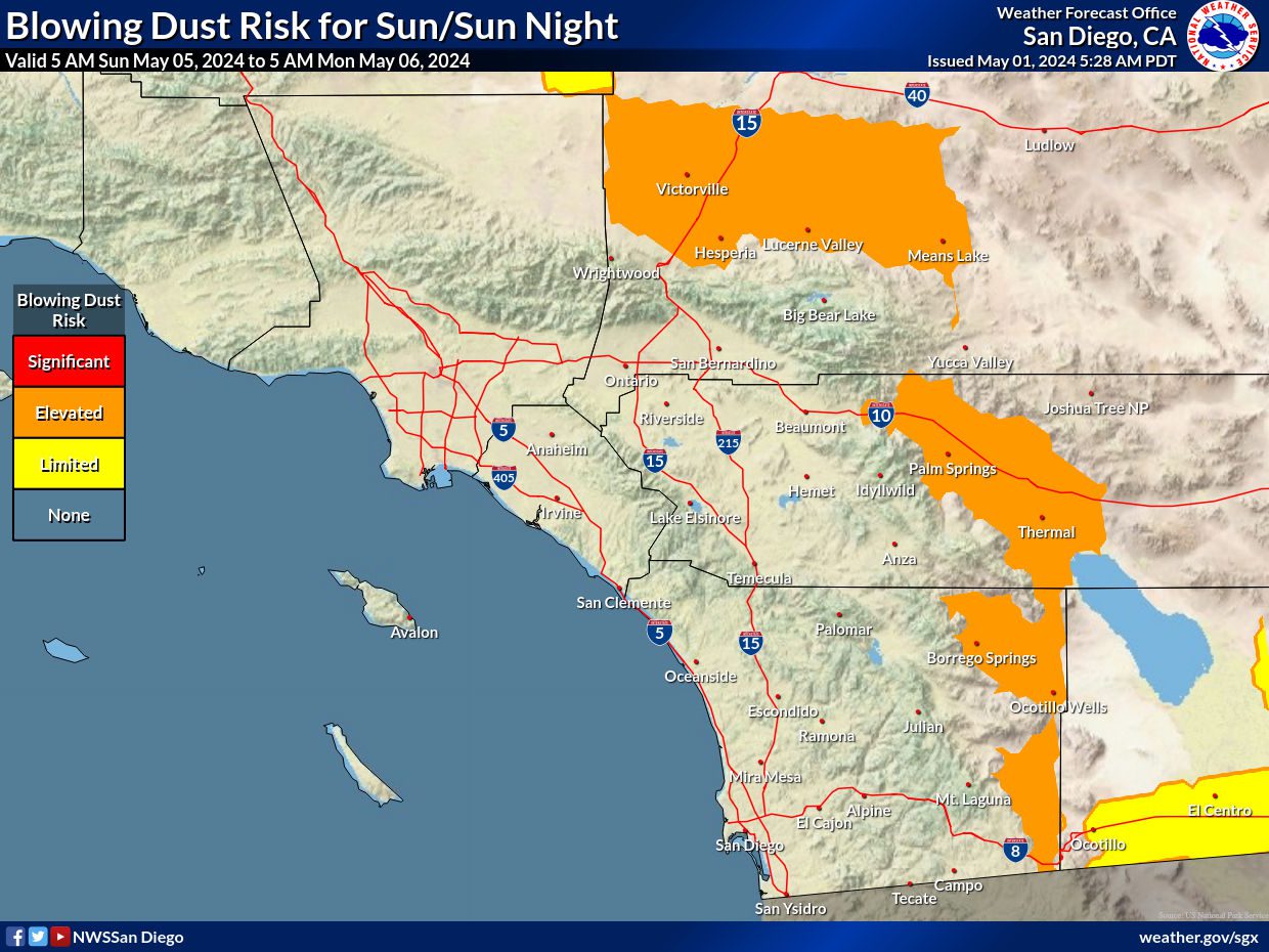
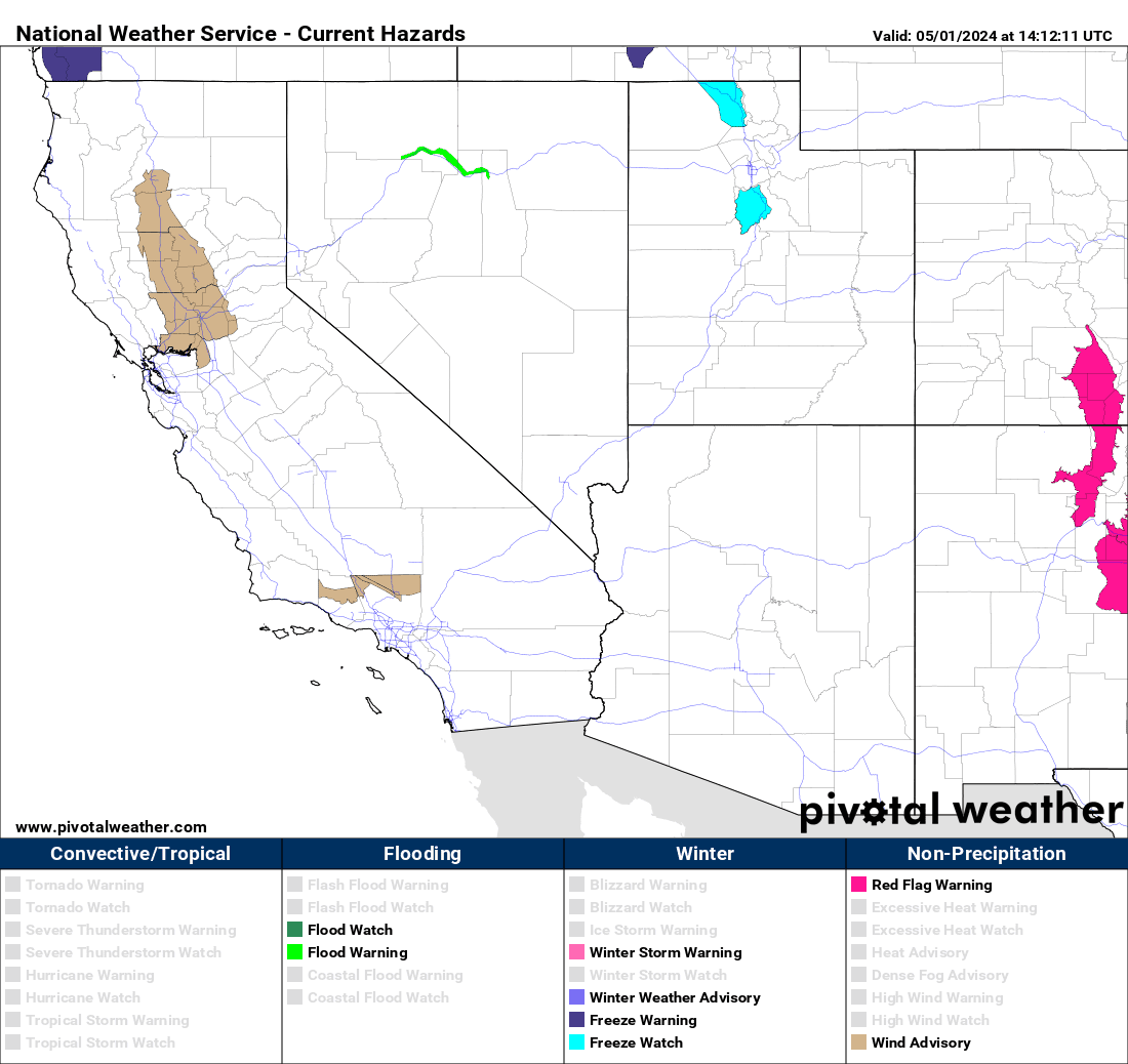
TODAY’S WEATHER WARNINGS
PACIFIC HURRICANE WEATHER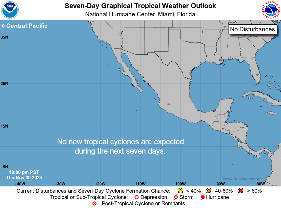
ATLANTIC HURRICANE WEATHER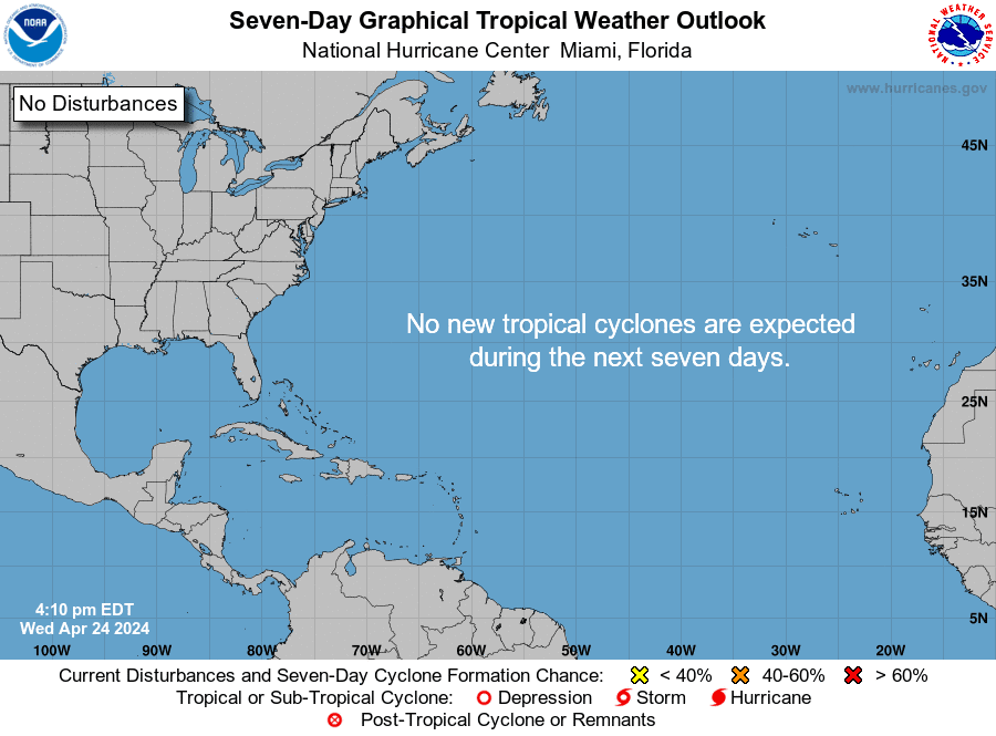
6-10 DAY TEMPERATURE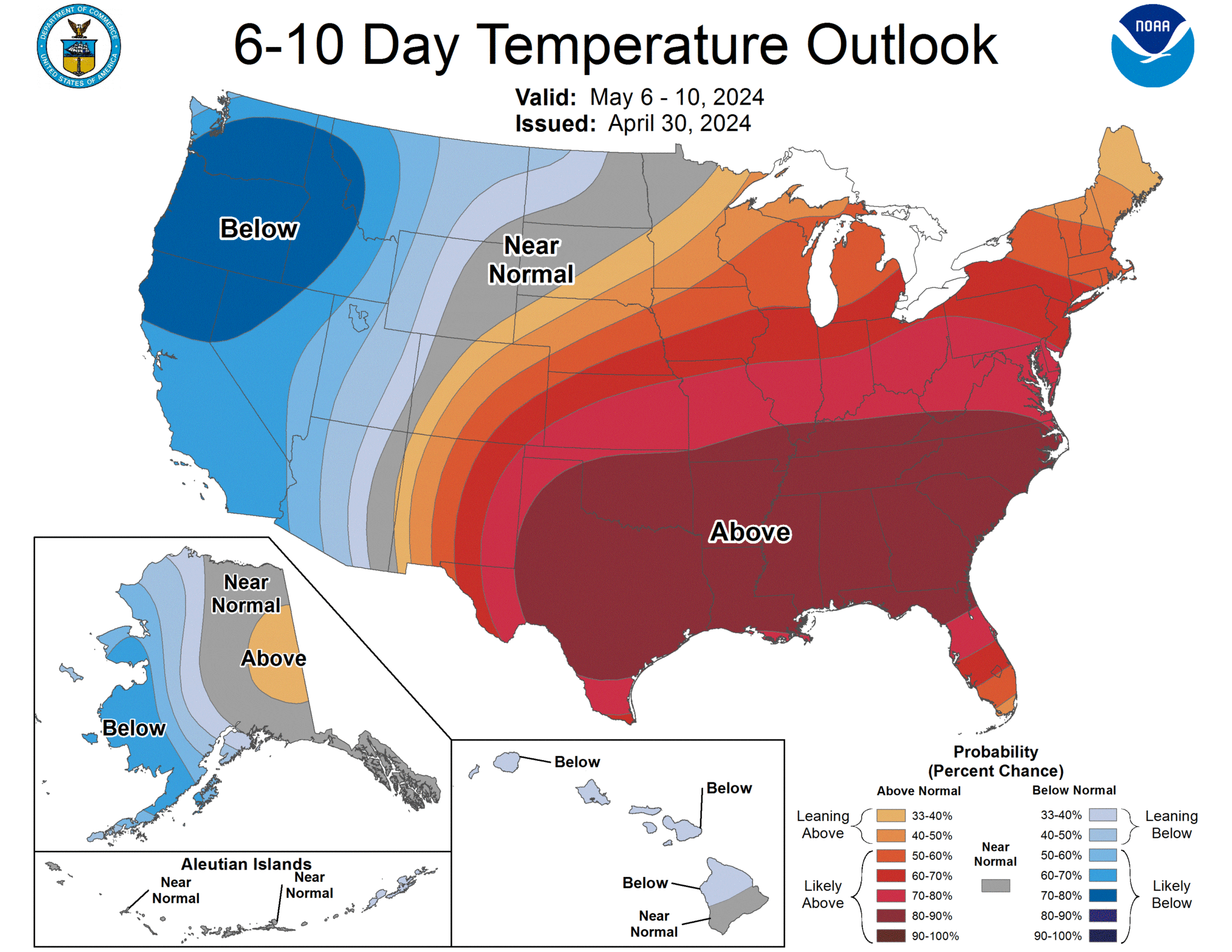
6-10 DAY PRECIPITATION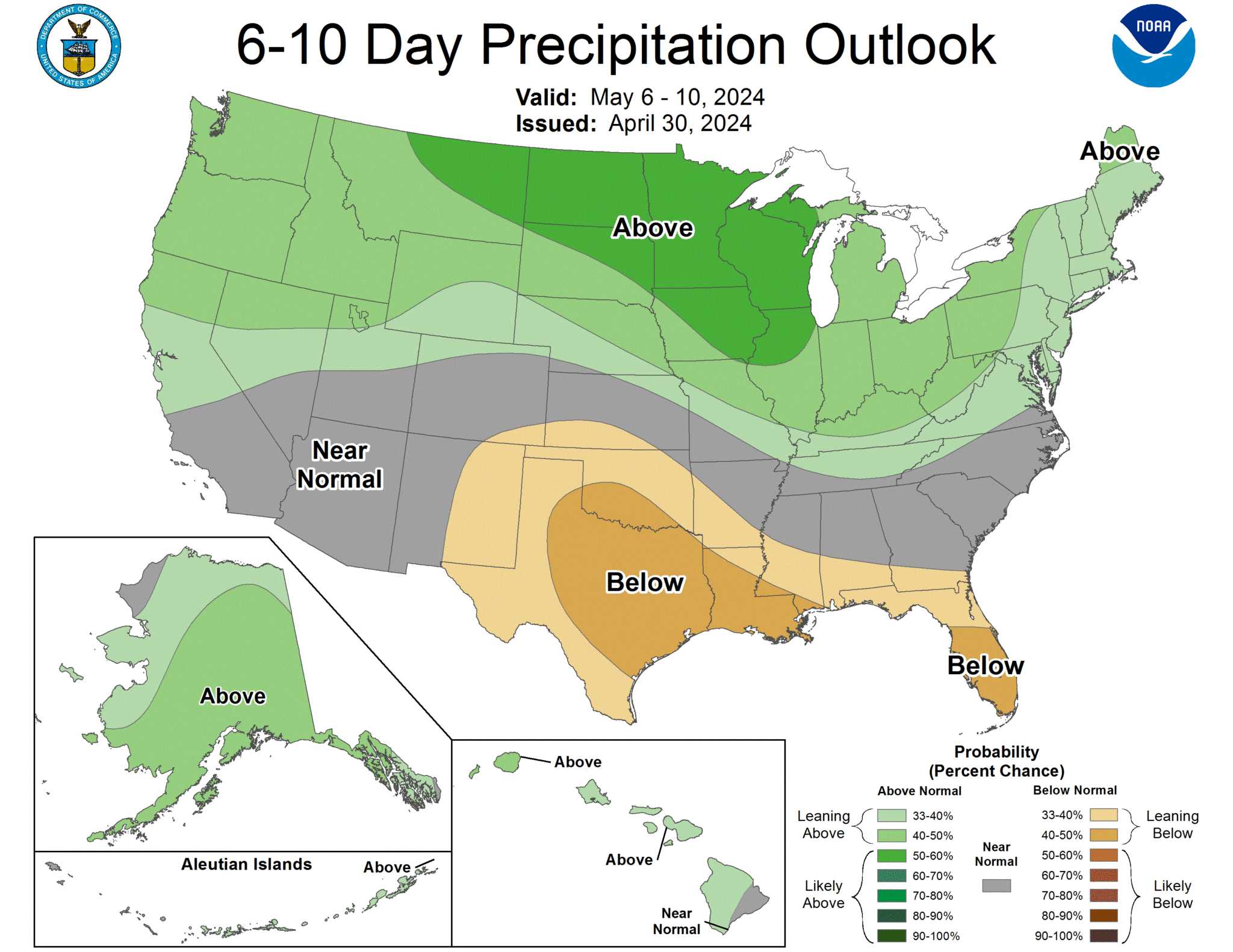
THUNDERSTORM OUTLOOK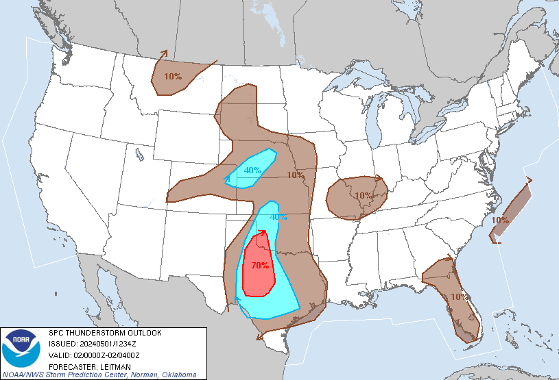
SPC WEATHER OUTLOOK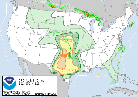
FIRE WEATHER OUTLOOK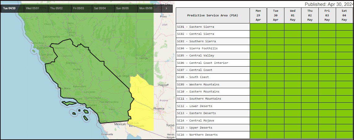
FIRE WEATHER FORECAST
Fire Weather Planning Forecast For Extreme Southwestern California
.DISCUSSION…There will be slight differences in the marine layer depth and high temperatures for the coast and valleys through Thursday with Wednesday a little cooler with the marine layer a little deeper. Slow cooling will begin to spread inland on Friday as onshore flow begins to strengthen with greater cooling for Saturday and Sunday with Sunday the coolest day with the strongest west to southwest winds for the mountains and deserts. Then warming with weaker winds for early next week.
.TODAY…Sky/weather………Mostly sunny.
Max temperature…..59 to 69 above 6000 feet to 65 to 75 below 6000 feet. 24 HR TREND……Up 4 degrees.
Min humidity……..20 to 30 percent.24 HR TREND……Down 5 percent.
WIND (20 FT)……..SLOPES………..Winds west 6 to 15 mph. Gusts to 30 mph.
RIDGETOP………Winds west 6 to 15 mph with gusts to 20 mph.
.TONIGHT…
Sky/weather………Mostly clear.
Min temperature…..34 to 44 above 6000 feet to 42 to 51 below 6000 feet. 24 HR TREND……Down 3 degrees.
Max humidity……..25 to 35 percent on desert slopes to 65 to 75 percent on coastal slopes. 24 HR TREND……Down 25 percent.
WIND (20 FT)……..SLOPES………..Winds west 6 to 16 mph with gusts to 25 mph.
RIDGETOP………Winds west 7 to 17 mph. Gusts to 30 mph.
.WEDNESDAY…
Sky/weather………Mostly sunny.
Max temperature…..57 to 67 above 6000 feet to 63 to 73 below 6000 feet.24 HR TREND……Down 3 degrees.
Min humidity……..15 percent on desert slopes to 20 to 30 percent on coastal slopes. 24 HR TREND……Little change.
WIND (20 FT)……..SLOPES………..Winds north 6 to 15 mph. Gusts to 25 mph.
RIDGETOP………Winds north 6 to 15 mph with gusts to 25 mph.
FORECAST DAYS 3 THROUGH 7…SUSTAINED WINDS LESS THAN 20 MPH EXCEPT WHEN SPECIFIED
.WEDNESDAY NIGHT…Clear. Lows in the upper 40s. North winds around 7 mph.
.THURSDAY…Sunny. Highs in the upper 60s. Northeast winds around 7 mph.
.THURSDAY NIGHT…Clear. Lows in the upper 40s. West winds around 7 mph.
.FRIDAY Sunny. Highs in the upper 60s. West winds around 7 mph. FRIDAY NIGHT…Clear. Lows in the upper 40s. West winds around 7 mph.
.SATURDAY…Mostly sunny. Highs in the mid 60s. West winds around 8 mph. .SATURDAY NIGHT…Mostly clear. Lows in the lower 40s.
.SUNDAY…Cooler. Partly cloudy. Highs in the mid 50s. .SUNDAY NIGHT…Mostly clear. Lows in the upper 30s.
.MONDAY…Mostly sunny. Highs around 60.