Below, you will find all of the local Highway information for the SoCal area. If you click on any of the links and add your HWY choice, the latest road and traffic information for that Highway or Interstate will be shown. These are updated by CALTRANS AND or the local CHP office continuously and contain current chain requirements for the Crestline, Lake Arrowhead, Running Springs and Big Bear areas, as well as any other Road or Highway announcements for that particular area. Highway 395 is also listed for those who travel to the Eastern Sierras. Below the Caltrans icons, local road work or areas of congestion may be posted at any time for HWYs 18, 330, 38, or 189, that may impact travel through the Crestline to Big Bear areas as well as local road work. This is another good source of information to help get local information to anyone commuting to the San Bernardino Mountain areas. So if you are headed to Crestline, Lake Arrowhead, Big Bear or Running Springs for the day, or heading home, this will be a good source of information for your commute.
LOCAL HIGHWAY WEBCAMS
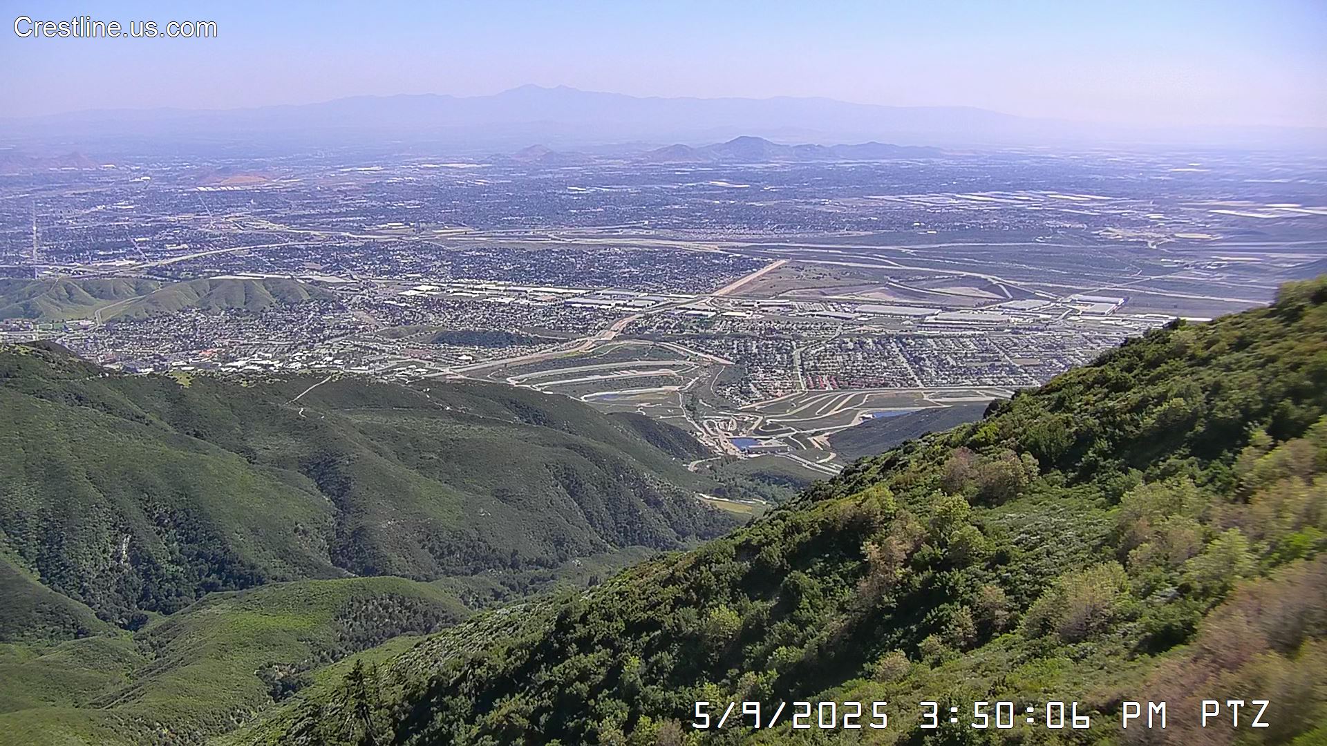
VIEW FROM PLAYGROUND DRIVE IN CRESTLINE
http://www.airsites2000.com/Crestline/broadcast.jpg 
BE SURE TO STAY IN TOUCH WITH “RimReporter”
FOR THE LATEST LOCAL NEWS AND TRAFFIC REPORTS ON FACEBOOK
TODAY’S LATEST ROAD CONDITIONS
Click the HWY sign below for the most up to date info on our local roads.
Click here for Quickmap


California State Route SR-18 Rim of the World Highway Traffic & CHP Incidents
![]()
California State Route SR-189 Traffic & CHP Incidents.
![]()
California State Route SR-330 Traffic & CHP Incidents in California
![]()
California State RouteR-173 Traffic & CHP Incidents in California
![]()
California State Route SR-38 Traffic & CHP Incidents
![]()
Highway SR-138 Traffic & CHP Incidents in California
![]() Highway US-395 Traffic & CHP Incidents in California
Highway US-395 Traffic & CHP Incidents in California
![]() Interstate 215 Traffic & CHP Incidents in California
Interstate 215 Traffic & CHP Incidents in California